Architecture overview
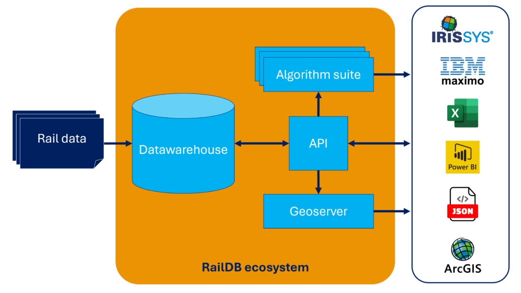
The RailDB ecosystem provides a suite of tools:
- Linear asset management (LAM) Datawarehouse as foundation;
- API for configuration and direct data-access;
- Algorithms to turn data into ready-made insights;
- Mapservices for spatial insight in webGIS or desktop GIS apps.
The RailDB ecosystem is back-end oriented, as front-end analysis and BI tools are highly available in the market. Many of these tools could work together with RailDB. RailDB provides the convenient LAM database system that allows direct access to the ocean of rail data. And it provides a suite of out-of-the-box algorithms to process this data into actionable information.

LAM datawarehouse
The datawarehouse provides the structured storage for all imported measurement data. The data is stored in collections and in a “model agnostic” manner. This powerful concept is explained further here. It allows quick imports and spatial queries across all collections using any available version of the railway model.
API
The API serves multiple purposes:
- It allows access to the data in the datawarehouse. Accessing data can be done based on location and time period using any available railway model.
- Planning jobs: these jobs can be anything from bulk importing and bulk exporting data to running algorithms on the data.
- Configuration of the datawarehouse: configuring new imports and exports.
- Configuration of algorithms: setting parameters that define the functionality and sensitivity of the algorithms.
The API allows easy integration with any third-party application and can be accessed directly for data science and business intelligence purposes.

Algorithm suite
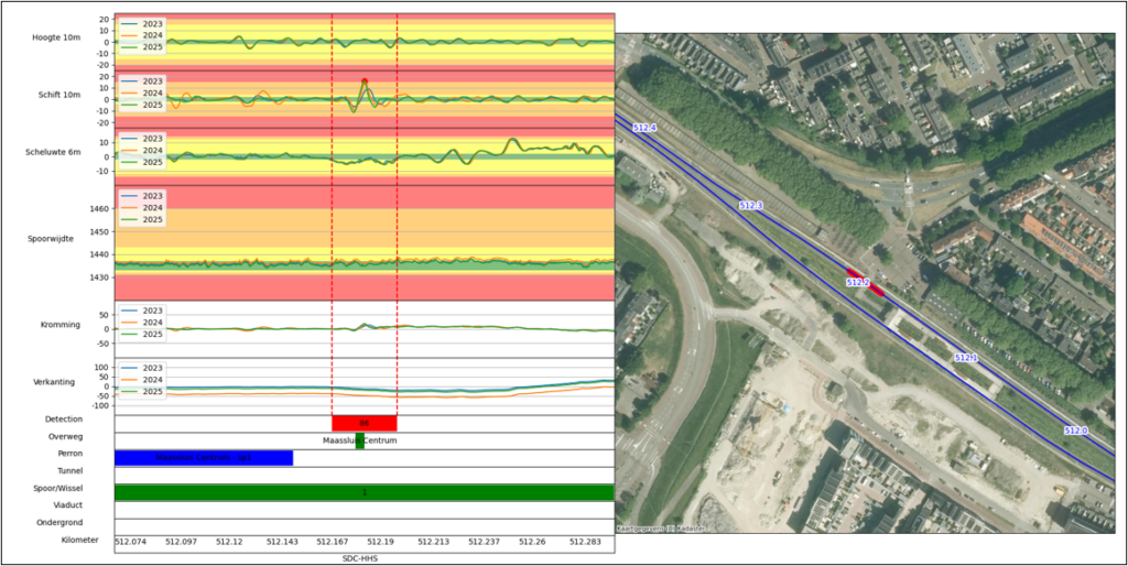
The algorithm suite provides standard automation for common analyses. The algorithms are based on condensed domain knowledge and are configurable by the end-user. Some algorithms predict geometry signals with trend analysis or indicate locations with safety issues. Others offer a more holistic approach with rolling windows and decision trees to find suitable locations for specific maintenance. The algorithms are the toolbox to extract relevant information out of the ocean of data. They provide significant time savings compared to manual analyses. Data scientists can of course also use the API to implement their own analyses and algorithms.
Mapservices
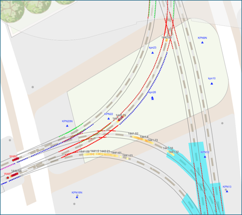
The algorithm suite produces highly tangible insights that often consists of suspect railway locations with specific geometry, wear or other issues. When planning follow-up actions to solve these issues a GIS map is an indispensable tool offering a convenient overview within a region of interest. The mapservices provide the geospatial insights through a standard WFS/WMS API to which you can connect your own webGIS or Desktop app.